Past IEM Features tagged: ero

Day 2 ERO Moderate Risk
14 Aug 2026 05:30 AMThe parade of thunderstorm complexes looks to continue on Friday and into the weekend. On Thursday, the Weather Prediction Center (WPC) issued a rare, for Iowa, Day 2 "moderate risk" of excessive rainfall for Friday into Saturday morning. The featured map presents the number of such issued risks since the start of the available archive during late 2015. Most of Iowa is shown having less than five such events over this period. Today's moderate risk was issued for southeastern Iowa, which has only slightly few more events on record. The IEM attempts to curate a downloadable archive of these outlooks and also has a simple search tool to find outlook events by a point location.
Voting:
Good: 23
Bad: 0
Abstain: 1
Tags: ero
Excessive Rainfall Outlooks
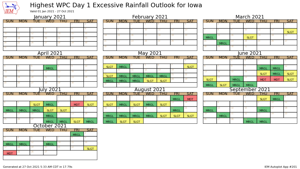
27 Oct 2021 05:35 AMMuch like how the Storm Prediction Center issues convective outlooks with categorical threat levels, the Weather Prediction Center issues excessive rainfall outlooks. These outlooks highlight risk levels associated with flash flooding from intense rainfall rates. The IEM attempts to process and archive these with the featured graphic presenting a calendar of maximum daily threat level over some portion of Iowa. A number of moderate risks can be seen with the most recent occurring this past Sunday.
Voting:
Good: 13
Bad: 2
Abstain: 1
Tags: ero wpc