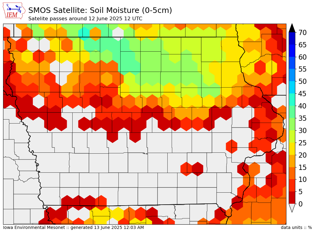
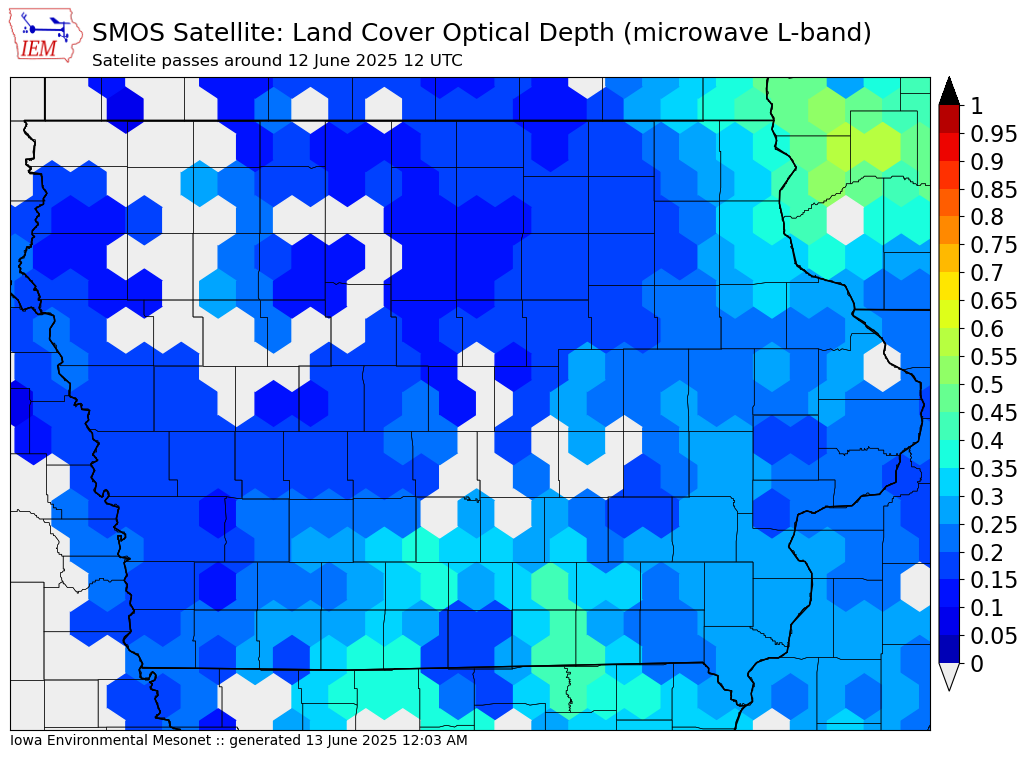
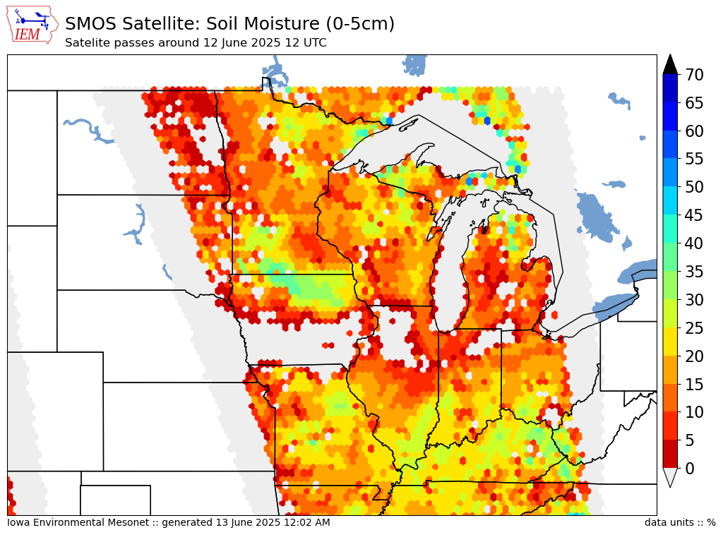
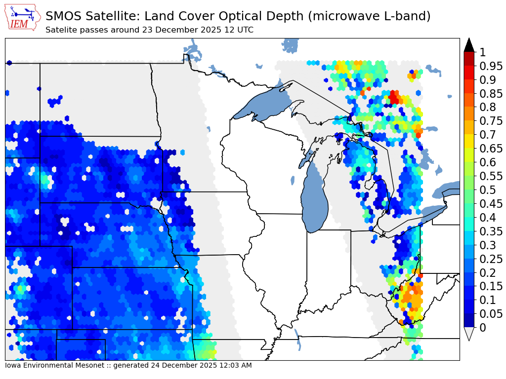
Soil Moisture & Ocean Salinity (SMOS) Satellite Data
The SMOS satellite is a polar orbiting satellite operated by the European Space Agency. The satellite provides estimates of soil moisture in the approximate top 5 centimeters of soil and the amount of vegetation on the land surface. Dr Brian Hornbuckle leads a local research team here at Iowa State that works with this data. The IEM collects processed data from this satellite, generates analysis plots, and makes the raw data available.
Download Data
This form allows you to download a single grid cell's worth of data based on
the latitude and longitude pair you provide. Data is only available here from
the Midwestern United States. The form will provide an error if you attempt
to request a point outside of the domain. Data is available since
31 May 2010.
Recent Analysis Plots at 00 UTC
Click image for archived imagery


Recent Analysis Plots at 12 UTC