'24-'25 Winter Storm #15
Posted:
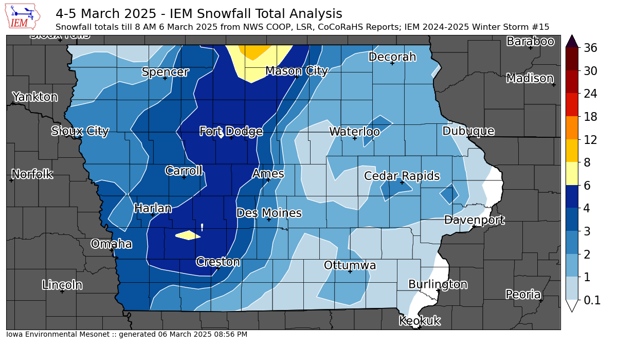
A major winter storm brought high winds, heavy snowfall, blizzard conditions, but also much needed rainfall to the state on Tuesday into Wednesday. Widespread rainfall amounts over an inch were found over much of the state with a quick transition to snow creating treacherous driving as a moisture rich slush froze and was compacted to ice. This system also featured upper echelon wind gusts with numerous locations topping 60 MPH. North central Iowa was particularly hard hit as the featured map shows the highest snowfall totals combined with the strong winds to create impassable snow drifts that will take considerable time to clear. The map analysis of snowfall over eastern Iowa is tricky as snow totals were lighter and the multi-day nature of the event with snow falling during the daytime on Wednesday with melting. Our next winter storm arrives this Thursday evening, but will be no where near as intense as this storm was.
Voting:
Good = 13
Bad = 2
Tags: winter2425
Voting:
Good = 13
Bad = 2
Tags: winter2425