National Weather Service Raw Text Product
Displaying AFOS PIL: SPSHGX Product Timestamp: 2019-04-18 08:22 UTC
Previous in Time Latest Product Next in Time
View All KHGX Products for 18 Apr 2019 View All SPS Products for 18 Apr 2019 View As Image Download As Text
783
WWUS84 KHGX 180822
SPSHGX
Special Weather Statement
National Weather Service Houston/Galveston TX
322 AM CDT Thu Apr 18 2019
TXZ163-164-177>179-180900-
San Jacinto TX-Walker TX-Polk TX-Houston TX-Trinity TX-
322 AM CDT Thu Apr 18 2019
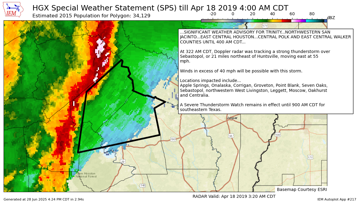
...SIGNIFICANT WEATHER ADVISORY FOR TRINITY...NORTHWESTERN SAN
JACINTO...EAST CENTRAL HOUSTON...CENTRAL POLK AND EAST CENTRAL WALKER
COUNTIES UNTIL 400 AM CDT...
At 322 AM CDT, Doppler radar was tracking a strong thunderstorm over
Sebastopol, or 21 miles northeast of Huntsville, moving east at 55
mph.
Winds in excess of 40 mph will be possible with this storm.
Locations impacted include...
Apple Springs, Onalaska, Corrigan, Groveton, Point Blank, Seven Oaks,
Sebastopol, northwestern West Livingston, Leggett, Moscow, Oakhurst
and Centralia.
A Severe Thunderstorm Watch remains in effect until 900 AM CDT for
southeastern Texas.
LAT...LON 3138 9495 3134 9496 3133 9490 3130 9489
3128 9488 3126 9490 3123 9486 3116 9485
3115 9486 3111 9475 3111 9472 3109 9466
3110 9465 3109 9464 3106 9456 3101 9466
3080 9461 3066 9536 3114 9528 3139 9496
TIME...MOT...LOC 0822Z 251DEG 49KT 3090 9527
$$
Autoplot 217 generated the following image below. You may find more customization options , like removal of RADAR, for this image by visiting that autoplot.
