National Weather Service Text Product
Displaying AFOS PIL: SPSBUF
Product Timestamp: 2019-02-24 19:31 UTC
Bulk Download Help
This bulk download tool provides the NWS text
in a raw form, hopefully directly usable by your processing system.
You can either provide a complete 6-character PIL/AFOS ID or provide
the 3-character base ID (e.g., AFD). The start and end
dates represent 00 UTC for those dates. The Zip format is useful as
the filenames will have the product timestamp, which is useful for
when the product format has ambiguous timestamps.
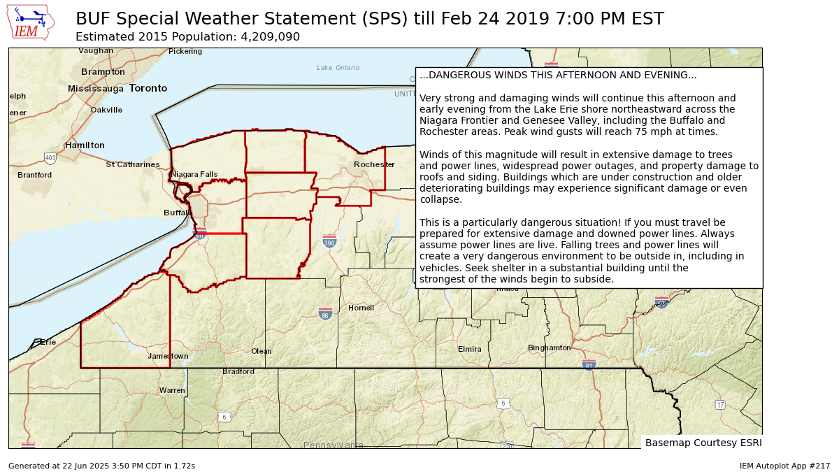
558
WWUS81 KBUF 241931
SPSBUF

Special Weather Statement
National Weather Service Buffalo NY
231 PM EST Sun Feb 24 2019

NYZ001>003-010>012-019-085-250000-
Niagara-Orleans-Monroe-Northern Erie-Genesee-Wyoming-Chautauqua-
Southern Erie-
Including the cities of Niagara Falls, Medina, Rochester,
Buffalo, Batavia, Warsaw, Jamestown, Orchard Park,
and Springville
231 PM EST Sun Feb 24 2019

...DANGEROUS WINDS THIS AFTERNOON AND EVENING...

Very strong and damaging winds will continue this afternoon and
early evening from the Lake Erie shore northeastward across the
Niagara Frontier and Genesee Valley, including the Buffalo and
Rochester areas. Peak wind gusts will reach 75 mph at times.

Winds of this magnitude will result in extensive damage to trees
and power lines, widespread power outages, and property damage to
roofs and siding. Buildings which are under construction and older
deteriorating buildings may experience significant damage or even
collapse.

This is a particularly dangerous situation! If you must travel be
prepared for extensive damage and downed power lines. Always
assume power lines are live. Falling trees and power lines will
create a very dangerous environment to be outside in, including in
vehicles. Seek shelter in a substantial building until the
strongest of the winds begin to subside.

$$

Hitchcock
Autoplot 217 generated the following image below. You may find more customization options , like removal of RADAR, for this image by visiting that autoplot.
