National Weather Service Raw Text Product
Found 2 products at the given pil and timestamp. Scroll down to see them all.
Displaying AFOS PIL: PNSUNR Product Timestamp: 2018-06-02 23:21 UTC
Previous in Time Latest Product Next in Time
View All KUNR Products for 02 Jun 2018 View All PNS Products for 02 Jun 2018 View As Image Download As Text
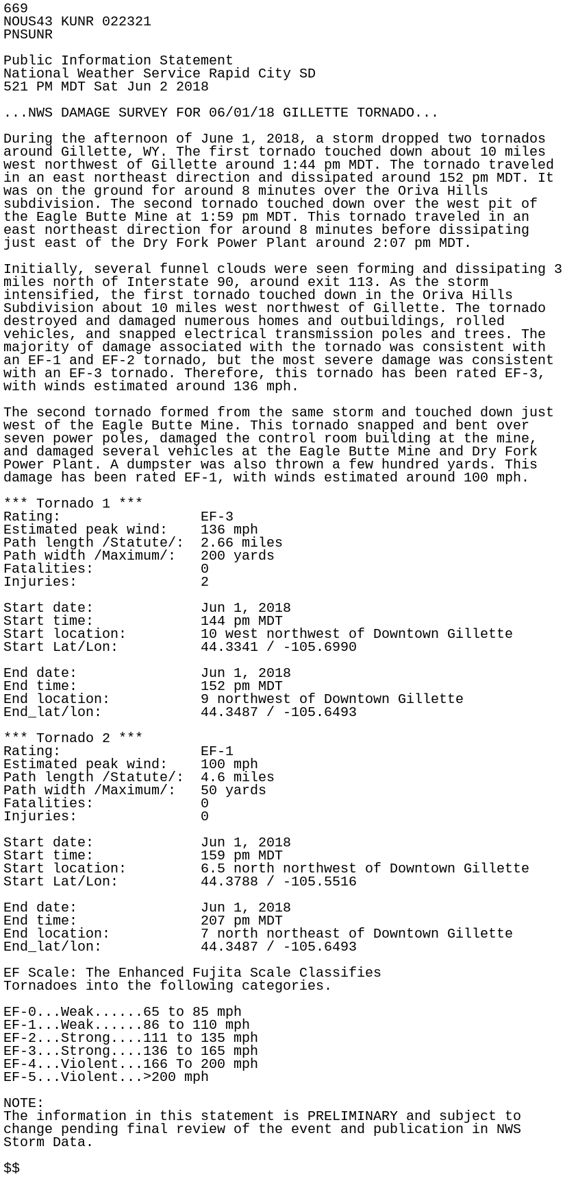
669
NOUS43 KUNR 022321
PNSUNR

Public Information Statement
National Weather Service Rapid City SD
521 PM MDT Sat Jun 2 2018

...NWS DAMAGE SURVEY FOR 06/01/18 GILLETTE TORNADO...

During the afternoon of June 1, 2018, a storm dropped two tornados
around Gillette, WY. The first tornado touched down about 10 miles
west northwest of Gillette around 1:44 pm MDT. The tornado traveled
in an east northeast direction and dissipated around 152 pm MDT. It
was on the ground for around 8 minutes over the Oriva Hills
subdivision. The second tornado touched down over the west pit of
the Eagle Butte Mine at 1:59 pm MDT. This tornado traveled in an
east northeast direction for around 8 minutes before dissipating
just east of the Dry Fork Power Plant around 2:07 pm MDT.

Initially, several funnel clouds were seen forming and dissipating 3
miles north of Interstate 90, around exit 113. As the storm
intensified, the first tornado touched down in the Oriva Hills
Subdivision about 10 miles west northwest of Gillette. The tornado
destroyed and damaged numerous homes and outbuildings, rolled
vehicles, and snapped electrical transmission poles and trees. The
majority of damage associated with the tornado was consistent with
an EF-1 and EF-2 tornado, but the most severe damage was consistent
with an EF-3 tornado. Therefore, this tornado has been rated EF-3,
with winds estimated around 136 mph.

The second tornado formed from the same storm and touched down just
west of the Eagle Butte Mine. This tornado snapped and bent over
seven power poles, damaged the control room building at the mine,
and damaged several vehicles at the Eagle Butte Mine and Dry Fork
Power Plant. A dumpster was also thrown a few hundred yards. This
damage has been rated EF-1, with winds estimated around 100 mph.

*** Tornado 1 ***
Rating:                 EF-3
Estimated peak wind:    136 mph
Path length /Statute/:  2.66 miles
Path width /Maximum/:   200 yards
Fatalities:             0
Injuries:               2

Start date:             Jun 1, 2018
Start time:             144 pm MDT
Start location:         10 west northwest of Downtown Gillette
Start Lat/Lon:          44.3341 / -105.6990

End date:               Jun 1, 2018
End time:               152 pm MDT
End location:           9 northwest of Downtown Gillette
End_lat/lon:            44.3487 / -105.6493

*** Tornado 2 ***
Rating:                 EF-1
Estimated peak wind:    100 mph
Path length /Statute/:  4.6 miles
Path width /Maximum/:   50 yards
Fatalities:             0
Injuries:               0

Start date:             Jun 1, 2018
Start time:             159 pm MDT
Start location:         6.5 north northwest of Downtown Gillette
Start Lat/Lon:          44.3788 / -105.5516

End date:               Jun 1, 2018
End time:               207 pm MDT
End location:           7 north northeast of Downtown Gillette
End_lat/lon:            44.3487 / -105.6493

EF Scale: The Enhanced Fujita Scale Classifies
Tornadoes into the following categories.

EF-0...Weak......65 to 85 mph
EF-1...Weak......86 to 110 mph
EF-2...Strong....111 to 135 mph
EF-3...Strong....136 to 165 mph
EF-4...Violent...166 To 200 mph
EF-5...Violent...>200 mph

NOTE:
The information in this statement is PRELIMINARY and subject to
change pending final review of the event and publication in NWS
Storm Data.

$$
929
NOUS43 KUNR 022357
PNSUNR

Public Information Statement
National Weather Service Rapid City SD
521 PM MDT Sat Jun 2 2018

...NWS DAMAGE SURVEY FOR 06/01/18 GILLETTE TORNADOES...

During the afternoon of June 1, 2018, a storm dropped two tornadoes
around Gillette, WY. The first tornado touched down about 10 miles
west northwest of Gillette around 1:44 pm MDT. The tornado traveled
in an east northeast direction and dissipated around 152 pm MDT. It
was on the ground for around 8 minutes over the Oriva Hills
subdivision. The second tornado touched down over the west pit of
the Eagle Butte Mine at 1:59 pm MDT. This tornado traveled in an
east northeast direction for around 8 minutes before dissipating
just east of the Dry Fork Power Plant around 2:07 pm MDT.

Initially, several funnel clouds were seen forming and dissipating 3
miles north of Interstate 90, around exit 113. As the storm
intensified, the first tornado touched down in the Oriva Hills
Subdivision about 10 miles west northwest of Gillette. The tornado
destroyed and damaged numerous homes and outbuildings, rolled
vehicles, and snapped electrical transmission poles and trees. The
majority of damage associated with the tornado was consistent with
an EF-1 and EF-2 tornado, but the most severe damage was consistent
with an EF-3 tornado. Therefore, this tornado has been rated EF-3,
with winds estimated around 136 mph.

The second tornado formed from the same storm and touched down just
west of the Eagle Butte Mine. This tornado snapped and bent over
seven power poles, damaged the control room building at the mine,
and damaged several vehicles at the Eagle Butte Mine and Dry Fork
Power Plant. A dumpster was also thrown a few hundred yards. This
damage has been rated EF-1, with winds estimated around 100 mph.

*** Tornado 1 ***
Rating:                 EF-3
Estimated peak wind:    136 mph
Path length /Statute/:  2.66 miles
Path width /Maximum/:   200 yards
Fatalities:             0
Injuries:               2

Start date:             Jun 1, 2018
Start time:             144 pm MDT
Start location:         10 west northwest of Downtown Gillette
Start Lat/Lon:          44.3341 / -105.6990

End date:               Jun 1, 2018
End time:               152 pm MDT
End location:           9 northwest of Downtown Gillette
End_lat/lon:            44.3487 / -105.6493

*** Tornado 2 ***
Rating:                 EF-1
Estimated peak wind:    100 mph
Path length /Statute/:  4.6 miles
Path width /Maximum/:   50 yards
Fatalities:             0
Injuries:               0

Start date:             Jun 1, 2018
Start time:             159 pm MDT
Start location:         6.5 north northwest of Downtown Gillette
Start Lat/Lon:          44.3788 / -105.5516

End date:               Jun 1, 2018
End time:               207 pm MDT
End location:           7 north northeast of Downtown Gillette
End_lat/lon:            44.3487 / -105.6493

EF Scale: The Enhanced Fujita Scale Classifies
Tornadoes into the following categories.

EF-0...Weak......65 to 85 mph
EF-1...Weak......86 to 110 mph
EF-2...Strong....111 to 135 mph
EF-3...Strong....136 to 165 mph
EF-4...Violent...166 To 200 mph
EF-5...Violent...>200 mph

NOTE:
The information in this statement is PRELIMINARY and subject to
change pending final review of the event and publication in NWS
Storm Data.

$$