National Weather Service Raw Text Product
Displaying AFOS PIL: SPSDMX Product Timestamp: 2025-06-12 19:31 UTC
Previous in Time Latest Product Next in Time
View All KDMX Products for 12 Jun 2025 View All SPS Products for 12 Jun 2025 View As Image Download As Text
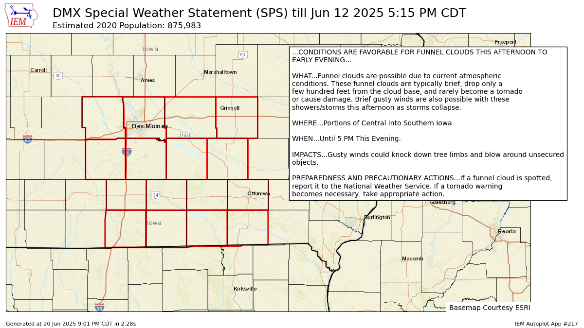
636
WWUS83 KDMX 121931
SPSDMX

Special Weather Statement
National Weather Service Des Moines IA
231 PM CDT Thu Jun 12 2025

IAZ059>062-072>075-083>086-094>097-122215-
Dallas-Polk-Jasper-Poweshiek-Madison-Warren-Marion-Mahaska-Clarke-
Lucas-Monroe-Wapello-Decatur-Wayne-Appanoose-Davis-
Including the cities of Perry, Waukee, Adel, Des Moines, Newton,
Grinnell, Winterset, Earlham, Indianola, Norwalk, Carlisle,
Pella, Knoxville, Oskaloosa, Osceola, Chariton, Albia, Ottumwa,
Lamoni, Leon, Corydon, Seymour, Allerton, Humeston, Centerville,
and Bloomfield
231 PM CDT Thu Jun 12 2025

...CONDITIONS ARE FAVORABLE FOR FUNNEL CLOUDS THIS AFTERNOON TO
EARLY EVENING...

WHAT...Funnel clouds are possible due to current atmospheric
conditions. These funnel clouds are typically brief, drop only a
few hundred feet from the cloud base, and rarely become a tornado
or cause damage. Brief gusty winds are also possible with these
showers/storms this afternoon as storms collapse.

WHERE...Portions of Central into Southern Iowa

WHEN...Until 5 PM This Evening.

IMPACTS...Gusty winds could knock down tree limbs and blow around unsecured
objects.

PREPAREDNESS AND PRECAUTIONARY ACTIONS...If a funnel cloud is spotted,
report it to the National Weather Service. If a tornado warning
becomes necessary, take appropriate action.

$$
Autoplot 217 generated the following image below. You may find more customization options , like removal of RADAR, for this image by visiting that autoplot.
