National Weather Service Raw Text Product
Displaying AFOS PIL: LSRIWX Product Timestamp: 2024-05-09 21:02 UTC
Previous in Time Latest Product Next in Time
View All KIWX Products for 09 May 2024 View All LSR Products for 09 May 2024 View As Image Download As Text
211
NWUS53 KIWX 092102
LSRIWX
Preliminary Local Storm Report
National Weather Service Northern Indiana
502 PM EDT Thu May 9 2024
..TIME... ...EVENT... ...CITY LOCATION... ...LAT.LON...
..DATE... ....MAG.... ..COUNTY LOCATION..ST.. ...SOURCE....
..REMARKS..
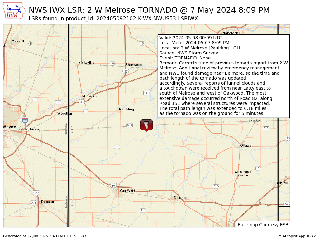
0809 PM Tornado 2 W Melrose 41.09N 84.46W
05/07/2024 Paulding OH NWS Storm Survey
Corrects time of previous tornado report
from 2 W Melrose. Additional review by
emergency management and NWS found damage
near Belmore, so the time and path length of
the tornado was updated accordingly. Several
reports of funnel clouds and a touchdown
were received from near Latty east to south
of Melrose and west of Oakwood. The most
extensive damage occurred north of Road 82,
along Road 151 where several structures were
impacted. The total path length was extended
to 6.18 miles as the tornado was on the
ground for 5 minutes.
&&
$$
MJ