National Weather Service Raw Text Product
Found 2 products at the given pil and timestamp. Scroll down to see them all.
Displaying AFOS PIL: LSRIWX Product Timestamp: 2024-05-09 20:57 UTC
Previous in Time Latest Product Next in Time
View All KIWX Products for 09 May 2024 View All LSR Products for 09 May 2024 View As Image Download As Text
344
NWUS53 KIWX 092057
LSRIWX
Preliminary Local Storm Report
National Weather Service Northern Indiana
457 PM EDT Thu May 9 2024
..TIME... ...EVENT... ...CITY LOCATION... ...LAT.LON...
..DATE... ....MAG.... ..COUNTY LOCATION..ST.. ...SOURCE....
..REMARKS..
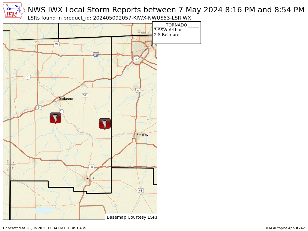
0816 PM Tornado 3 SSW Arthur 41.16N 84.39W
05/07/2024 Paulding OH NWS Storm Survey
Emergency management sent drone footage
which shows scoured dirt through a freshly
plowed field along Road 166 between Road 191
and Ohio 66. The track terminates near a
large metal outbuilding (at the intersection
of OH 66 and Road 158) which lost about half
of its metal roof panels on the north-facing
side, and about 1/4 of its panels on the
south facing side. The tornado was on the
ground for a minute and the damage path was
about a half mile. Rated EF-0 with maximum
winds 70 mph.
&&
$$
MJ
904
NWUS53 KIWX 092057
LSRIWX

Preliminary Local Storm Report
National Weather Service Northern Indiana
457 PM EDT Thu May 9 2024

..TIME...   ...EVENT...      ...CITY LOCATION...     ...LAT.LON...
..DATE...   ....MAG....      ..COUNTY LOCATION..ST.. ...SOURCE....
            ..REMARKS..

0854 PM     Tornado          2 S Belmore             41.12N 83.94W
05/07/2024                   Putnam             OH   NWS Storm Survey

            A trained spotter reported a brief tornado
            touched down south of Belmore, OH at 8:54 PM
            EDT May 7th. Videos confirm that a tornado
            did touch down in a field just east of
            Little Yellow Creek, south of Iams Avenue
            and west of Road 4. The tornado was on the
            ground for less than a minute. It dissipated
            over the field and did not cause any known
            damage.


&&

$$

MJ