National Weather Service Raw Text Product
Displaying AFOS PIL: PNSFWD Product Timestamp: 2018-10-10 01:17 UTC
Previous in Time Latest Product Next in Time
View All KFWD Products for 10 Oct 2018 View All PNS Products for 10 Oct 2018 View As Image Download As Text
693
NOUS44 KFWD 100117
PNSFWD
TXZ091>095-100>107-115>123-129>135-141>148-156>162-174-175-101330-
Public Information Statement
National Weather Service Fort Worth TX
817 PM CDT Tue Oct 9 2018
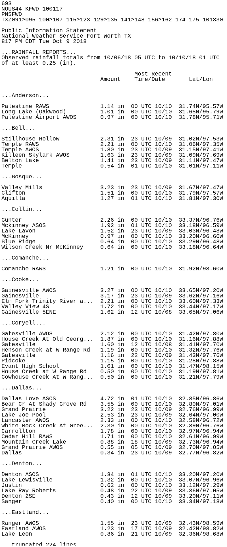
...RAINFALL REPORTS...
Observed rainfall totals from 10/06/18 05 UTC to 10/10/18 01 UTC
of at least 0.25 (in).
Most Recent
Amount Time/Date Lat/Lon
...Anderson...
Palestine RAWS 1.14 in 00 UTC 10/10 31.74N/95.57W
Long Lake (Oakwood) 1.01 in 00 UTC 10/10 31.65N/95.79W
Palestine Airport AWOS 0.97 in 00 UTC 10/10 31.78N/95.71W
...Bell...
Stillhouse Hollow 2.31 in 23 UTC 10/09 31.02N/97.53W
Temple RAWS 2.21 in 00 UTC 10/10 31.06N/97.35W
Temple AWOS 1.80 in 23 UTC 10/09 31.15N/97.41W
Killeen Skylark AWOS 1.63 in 23 UTC 10/09 31.09N/97.69W
Belton Lake 1.41 in 23 UTC 10/09 31.11N/97.47W
Temple 0.54 in 01 UTC 10/10 31.01N/97.11W
...Bosque...
Valley Mills 3.23 in 23 UTC 10/09 31.67N/97.47W
Clifton 1.51 in 00 UTC 10/10 31.79N/97.57W
Aquilla 1.27 in 01 UTC 10/10 31.81N/97.30W
...Collin...
Gunter 2.26 in 00 UTC 10/10 33.37N/96.76W
Mckinney ASOS 1.92 in 01 UTC 10/10 33.18N/96.59W
Lake Lavon 1.52 in 23 UTC 10/09 33.03N/96.48W
McKinney 0.97 in 00 UTC 10/10 33.20N/96.60W
Blue Ridge 0.64 in 00 UTC 10/10 33.29N/96.48W
Wilson Creek Nr McKinney 0.64 in 00 UTC 10/10 33.18N/96.64W
...Comanche...
Comanche RAWS 1.21 in 00 UTC 10/10 31.92N/98.60W
...Cooke...
Gainesville AWOS 3.27 in 00 UTC 10/10 33.65N/97.20W
Gainesville 3.17 in 23 UTC 10/09 33.62N/97.16W
Elm Fork Trinity River a... 2.21 in 00 UTC 10/10 33.60N/97.33W
Valley View 4S 1.72 in 00 UTC 10/10 33.44N/97.17W
Gainesville 5ENE 1.62 in 12 UTC 10/08 33.65N/97.06W
...Coryell...
Gatesville AWOS 2.12 in 00 UTC 10/10 31.42N/97.80W
House Creek At Old Georg... 1.87 in 00 UTC 10/10 31.16N/97.88W
Gatesville 1.60 in 12 UTC 10/08 31.41N/97.70W
Henson Creek at W Range Rd 1.19 in 00 UTC 10/10 31.32N/97.76W
Gatesville 1.16 in 22 UTC 10/09 31.43N/97.76W
Pidcoke 1.15 in 00 UTC 10/10 31.28N/97.88W
Evant High School 1.01 in 00 UTC 10/10 31.47N/98.15W
House Creek at W Range Rd 0.50 in 00 UTC 10/10 31.19N/97.81W
Cowhouse Creek At W Rang... 0.50 in 00 UTC 10/10 31.21N/97.79W
...Dallas...
Dallas Love ASOS 4.72 in 01 UTC 10/10 32.85N/96.86W
Bear Cr At Shady Grove Rd 3.55 in 00 UTC 10/10 32.80N/97.01W
Grand Prairie 3.22 in 23 UTC 10/09 32.76N/96.99W
Lake Joe Pool 2.53 in 23 UTC 10/09 32.64N/97.00W
Lancaster AWOS 2.33 in 00 UTC 10/10 32.58N/96.72W
White Rock Creek At Gree... 2.30 in 00 UTC 10/10 32.89N/96.76W
Carrollton 1.78 in 00 UTC 10/10 32.97N/96.94W
Cedar Hill RAWS 1.71 in 00 UTC 10/10 32.61N/96.99W
Mountain Creek Lake 0.88 in 18 UTC 10/09 32.73N/96.94W
Grand Prairie AWOS 0.55 in 05 UTC 10/09 32.70N/97.05W
Dallas 0.34 in 23 UTC 10/09 32.77N/96.82W
...Denton...
Denton ASOS 1.84 in 01 UTC 10/10 33.20N/97.20W
Lake Lewisville 1.32 in 00 UTC 10/10 33.07N/96.96W
Justin 0.62 in 00 UTC 10/10 33.12N/97.29W
Lake Ray Roberts 0.48 in 22 UTC 10/09 33.36N/97.05W
Denton 2SE 0.43 in 12 UTC 10/09 33.20N/97.11W
Sanger 0.40 in 00 UTC 10/10 33.34N/97.18W
...Eastland...
Ranger AWOS 1.55 in 23 UTC 10/09 32.43N/98.59W
Eastland AWOS 1.23 in 17 UTC 10/09 32.42N/98.82W
Lake Leon 0.86 in 21 UTC 10/09 32.36N/98.68W
...Ellis...
Chambers Cr At FM55 2.22 in 00 UTC 10/10 32.16N/96.76W
Rosser 2.21 in 00 UTC 10/10 32.43N/96.46W
Bardwell Lake 1.95 in 00 UTC 10/10 32.25N/96.64W
Waxahachie AWOS 1.57 in 00 UTC 10/10 32.46N/96.91W
Lake Waxahachie 1.23 in 00 UTC 10/10 32.34N/96.81W
...Erath...
Stephenville 1N 1.06 in 12 UTC 10/09 32.23N/98.23W
Stephenville AWOS 0.85 in 00 UTC 10/10 32.22N/98.18W
...Falls...
Highbank 1.77 in 00 UTC 10/10 31.13N/96.82W
Marlin 3NE 1.28 in 12 UTC 10/09 31.33N/96.86W
...Fannin...
Bonham AWOS 2.01 in 23 UTC 10/09 33.61N/96.18W
Caddo Grasslands RAWS 1.49 in 00 UTC 10/10 33.75N/95.93W
Bonham 3NNE 1.20 in 12 UTC 10/09 33.64N/96.17W
Ladonia 0.78 in 00 UTC 10/10 33.42N/95.94W
...Freestone...
Streetman 1.83 in 00 UTC 10/10 31.85N/96.29W
...Grayson...
Desert Water Coop#2 Hw160 2.92 in 00 UTC 10/10 33.43N/96.40W
Sherman/denison AWOS 2.65 in 00 UTC 10/10 33.71N/96.67W
Collinsville 1.63 in 00 UTC 10/10 33.53N/96.81W
...Hamilton...
Hamilton AWOS 1.82 in 00 UTC 10/10 31.67N/98.15W
Hamilton 1.75 in 00 UTC 10/10 31.79N/98.12W
...Henderson...
Trinidad 1.47 in 01 UTC 10/10 32.15N/96.10W
Cedar Creek Lake 0.95 in 00 UTC 10/10 32.24N/96.14W
Athens Raws 0.65 in 22 UTC 10/09 32.22N/95.77W
...Hill...
Covington 4.37 in 00 UTC 10/10 32.19N/97.26W
Ash Creek Near Malone 3.26 in 00 UTC 10/10 31.91N/96.88W
Hillsboro AWOS 2.99 in 00 UTC 10/10 32.08N/97.10W
Richland Cr Nr Mertens 2.60 in 00 UTC 10/10 32.05N/96.90W
Aquilla Lake 1.32 in 00 UTC 10/10 31.90N/97.20W
Blum 0.51 in 00 UTC 10/10 32.15N/97.40W
Aquilla Creek Below Dam 0.25 in 01 UTC 10/10 31.90N/97.20W
...Hood...
Granbury RAWS 1.19 in 00 UTC 10/10 32.45N/97.82W
Granbury AWOS 1.18 in 23 UTC 10/09 32.44N/97.82W
Lake Granbury 0.40 in 23 UTC 10/09 32.37N/97.69W
Lipan 0.34 in 12 UTC 10/08 32.52N/98.05W
...Hopkins...
Sulphur Springs AWOS 0.95 in 00 UTC 10/10 33.16N/95.62W
...Hunt...
Celeste 1.85 in 00 UTC 10/10 33.30N/96.24W
Greenville AWOS 1.05 in 00 UTC 10/10 33.07N/96.07W
Greenville RAWS 0.83 in 00 UTC 10/10 33.04N/96.16W
Commerce 0.78 in 00 UTC 10/10 33.27N/95.92W
Commerce 0.70 in 22 UTC 10/09 33.21N/95.91W
Greenville 0.52 in 22 UTC 10/09 33.13N/96.08W
...Jack...
Jacksboro 2.03 in 01 UTC 10/10 33.29N/98.08W
Jacksboro 1.44 in 12 UTC 10/09 33.24N/98.15W
...Johnson...
Venus 2.61 in 00 UTC 10/10 32.49N/97.12W
...Kaufman...
Rosser 2.13 in 12 UTC 10/09 32.46N/96.44W
Kaufman 1.99 in 00 UTC 10/10 32.56N/96.34W
Terrell ASOS 1.92 in 01 UTC 10/10 32.71N/96.27W
...Lamar...
Pat Mayse Dam 1.56 in 00 UTC 10/10 33.85N/95.54W
Paris AWOS 1.28 in 23 UTC 10/09 33.64N/95.45W
Roxton 0.28 in 00 UTC 10/10 33.54N/95.72W
...Lampasas...
Kempner 1.34 in 23 UTC 10/09 31.08N/98.02W
Lampasas Airport AWOS 1.23 in 00 UTC 10/10 31.11N/98.20W
...Limestone...
Mexia Airport AWOS 2.04 in 23 UTC 10/09 31.64N/96.51W
Freestone 5SW 1.72 in 00 UTC 10/10 31.51N/96.32W
Lake Mexia 0.98 in 22 UTC 10/09 31.64N/96.58W
Groesbeck 0.26 in 23 UTC 10/09 31.57N/96.52W
...McLennan...
Waco ASOS 3.72 in 01 UTC 10/10 31.61N/97.23W
McGregor AWOS 2.57 in 23 UTC 10/09 31.48N/97.32W
McGregor RAWS 2.49 in 00 UTC 10/10 31.38N/97.41W
Crawford 1.80 in 23 UTC 10/09 31.56N/97.36W
McGregor 1.46 in 23 UTC 10/09 31.51N/97.37W
West 1.17 in 12 UTC 10/09 31.80N/97.10W
...Milam...
Cameron AWOS 1.73 in 23 UTC 10/09 30.88N/96.97W
Brazos River at FM 485 N... 1.58 in 00 UTC 10/10 30.87N/96.70W
...Mills...
Browns Creek Nr Goldthwa... 3.39 in 00 UTC 10/10 31.52N/98.57W
...Montague...
Bowie AWOS 2.50 in 23 UTC 10/09 33.60N/97.77W
Forestburg 5S 2.45 in 12 UTC 10/08 33.46N/97.57W
Lake Amon Carter 2.16 in 01 UTC 10/10 33.47N/97.86W
Bowie 1.96 in 12 UTC 10/08 33.55N/97.85W
Montague 1.85 in 00 UTC 10/10 33.65N/97.76W
...Navarro...
Corsicana ASOS 2.49 in 01 UTC 10/10 32.03N/96.40W
Richland Chambers Lake 0.97 in 00 UTC 10/10 32.04N/96.21W
Corsicana 0.91 in 12 UTC 10/09 32.12N/96.49W
...Palo Pinto...
Possum Kingdom RAWS 1.98 in 00 UTC 10/10 32.87N/98.55W
Palo Pinto Creek at Wate... 1.52 in 00 UTC 10/10 32.63N/98.13W
Possum Kingdom Lake 0.97 in 00 UTC 10/10 32.87N/98.43W
Palo Pinto 0.42 in 22 UTC 10/09 32.86N/98.30W
...Parker...
Mineral Wells ASOS 1.18 in 01 UTC 10/10 32.78N/98.06W
Cresson - Bourland Field... 0.79 in 00 UTC 10/10 32.59N/97.59W
Weatherford 0.33 in 12 UTC 10/09 32.75N/97.77W
Reno 0.31 in 00 UTC 10/10 32.95N/97.58W
Weatherford 0.27 in 00 UTC 10/10 32.74N/97.65W
...Robertson...
Round Prairie RAWS 1.72 in 00 UTC 10/10 31.30N/96.37W
Hearne AWOS 1.46 in 00 UTC 10/10 30.87N/96.62W
Little Brazos River at F... 0.85 in 00 UTC 10/10 30.88N/96.64W
Easterly 0.84 in 00 UTC 10/10 31.17N/96.30W
...Rockwall...
Rockwall Airport AWOS 1.57 in 23 UTC 10/09 32.93N/96.44W
...Somervell...
Glen Rose 1.26 in 01 UTC 10/10 32.23N/97.78W
Glen Rose 1.21 in 23 UTC 10/09 32.26N/97.70W
...Stephens...
Hubbard Creek Reservoir 3.05 in 00 UTC 10/10 32.78N/99.01W
Breckenridge AWOS 2.43 in 00 UTC 10/10 32.72N/98.89W
...Tarrant...
West Fork Trinity River ... 3.51 in 00 UTC 10/10 32.79N/97.14W
Arlington ASOS 3.45 in 01 UTC 10/10 32.66N/97.10W
DFW Airport ASOS 3.26 in 01 UTC 10/10 32.90N/97.02W
Mansfield 3.12 in 00 UTC 10/10 32.58N/97.10W
Grapevine Dam Wx Station 3.02 in 00 UTC 10/10 32.95N/97.06W
Keller 2.11 in 12 UTC 10/09 32.90N/97.28W
FTW Alliance ASOS 1.95 in 01 UTC 10/10 32.99N/97.32W
Haltom City 1.74 in 00 UTC 10/10 32.81N/97.25W
Fort Worth 1.37 in 23 UTC 10/09 32.76N/97.33W
FTW Meacham ASOS 1.33 in 01 UTC 10/10 32.82N/97.35W
Fort Worth 1.22 in 00 UTC 10/10 32.76N/97.40W
Lake Grapevine 1.07 in 22 UTC 10/09 32.97N/97.06W
Lake Arlington 0.81 in 23 UTC 10/09 32.72N/97.19W
Marys Creek 0.66 in 00 UTC 10/10 32.70N/97.45W
Arlington 0.61 in 12 UTC 10/09 32.76N/97.07W
Benbrook 0.60 in 01 UTC 10/10 32.67N/97.44W
Lake Benbrook 0.58 in 23 UTC 10/09 32.65N/97.45W
Eagle Mountain Lake 0.56 in 00 UTC 10/10 32.88N/97.47W
Fort Worth 0.51 in 00 UTC 10/10 32.73N/97.36W
Fort Worth 0.39 in 00 UTC 10/10 32.75N/97.29W
Fort Worth 0.34 in 12 UTC 10/09 32.70N/97.44W
...Wise...
Decatur AWOS 1.53 in 00 UTC 10/10 33.25N/97.58W
Alvord 4NE 1.20 in 23 UTC 10/09 33.39N/97.64W
LBJ Grasslands RAWS 1.00 in 00 UTC 10/10 33.28N/97.63W
Bridgeport AWOS 0.88 in 00 UTC 10/10 33.18N/97.83W
Boyd 0.51 in 00 UTC 10/10 33.09N/97.56W
Decatur 0.42 in 12 UTC 10/09 33.23N/97.62W
Denton Creek Near Deca... 0.35 in 00 UTC 10/10 33.28N/97.42W
...Young...
Eliasville 2.89 in 00 UTC 10/10 32.96N/98.77W
Lake Graham 0.71 in 00 UTC 10/10 33.13N/98.61W
Graham AWOS 0.70 in 17 UTC 10/09 33.11N/98.56W
Observations are collected from a variety of sources with varying
equipment and exposures. Not all data listed are considered
official. Any locations marked with an asterisk (*) may have
incomplete data during the valid time period.
$$