National Weather Service Text Product
Displaying AFOS PIL: SPSJAX
Product Timestamp: 2017-08-08 18:44 UTC
Bulk Download Help
This bulk download tool provides the NWS text
in a raw form, hopefully directly usable by your processing system.
You can either provide a complete 6-character PIL/AFOS ID or provide
the 3-character base ID (e.g., AFD). The start and end
dates represent 00 UTC for those dates. The Zip format is useful as
the filenames will have the product timestamp, which is useful for
when the product format has ambiguous timestamps.
968
WWUS82 KJAX 081844
SPSJAX
Special Weather Statement
National Weather Service Jacksonville FL
244 PM EDT TUE AUG 8 2017
FLZ033-081915-
St. Johns FL-
244 PM EDT TUE AUG 8 2017
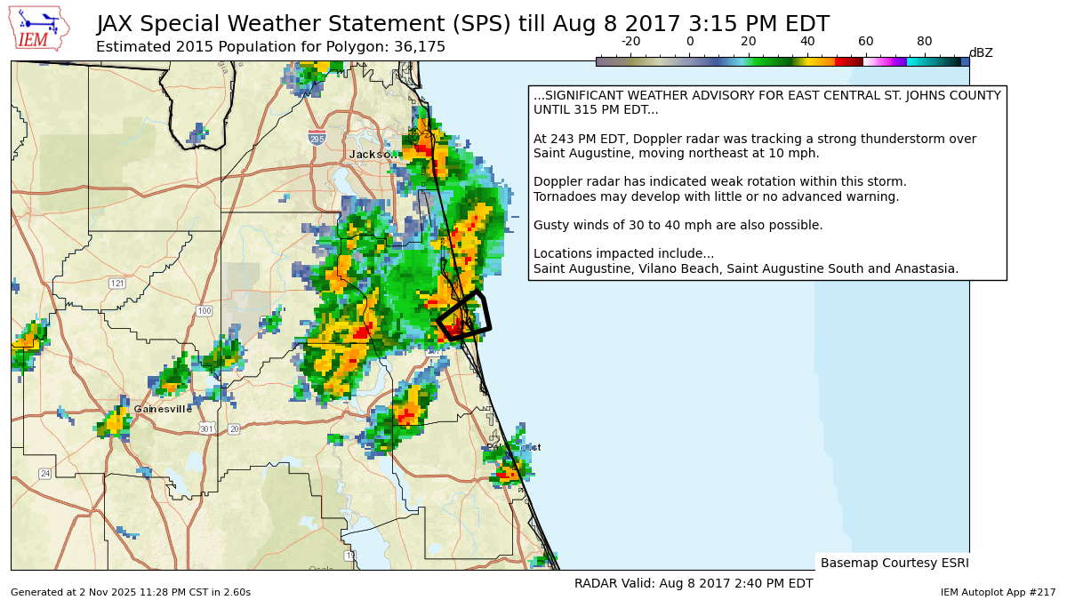
...SIGNIFICANT WEATHER ADVISORY FOR EAST CENTRAL ST. JOHNS COUNTY
UNTIL 315 PM EDT...
At 243 PM EDT, Doppler radar was tracking a strong thunderstorm over
Saint Augustine, moving northeast at 10 mph.
Doppler radar has indicated weak rotation within this storm.
Tornadoes may develop with little or no advanced warning.
Gusty winds of 30 to 40 mph are also possible.
Locations impacted include...
Saint Augustine, Vilano Beach, Saint Augustine South and Anastasia.
LAT...LON 2985 8134 2990 8138 2998 8126 2996 8124
2988 8122
TIME...MOT...LOC 1843Z 242DEG 8KT 2989 8132
$$
ENYEDI
Autoplot 217 generated the following image below. You may find more customization options , like removal of RADAR, for this image by visiting that autoplot.
