National Weather Service Text Product
Displaying AFOS PIL: SPSOAX
Product Timestamp: 2016-02-19 09:31 UTC
Bulk Download Help
This bulk download tool provides the NWS text
in a raw form, hopefully directly usable by your processing system.
You can either provide a complete 6-character PIL/AFOS ID or provide
the 3-character base ID (e.g., AFD). The start and end
dates represent 00 UTC for those dates. The Zip format is useful as
the filenames will have the product timestamp, which is useful for
when the product format has ambiguous timestamps.
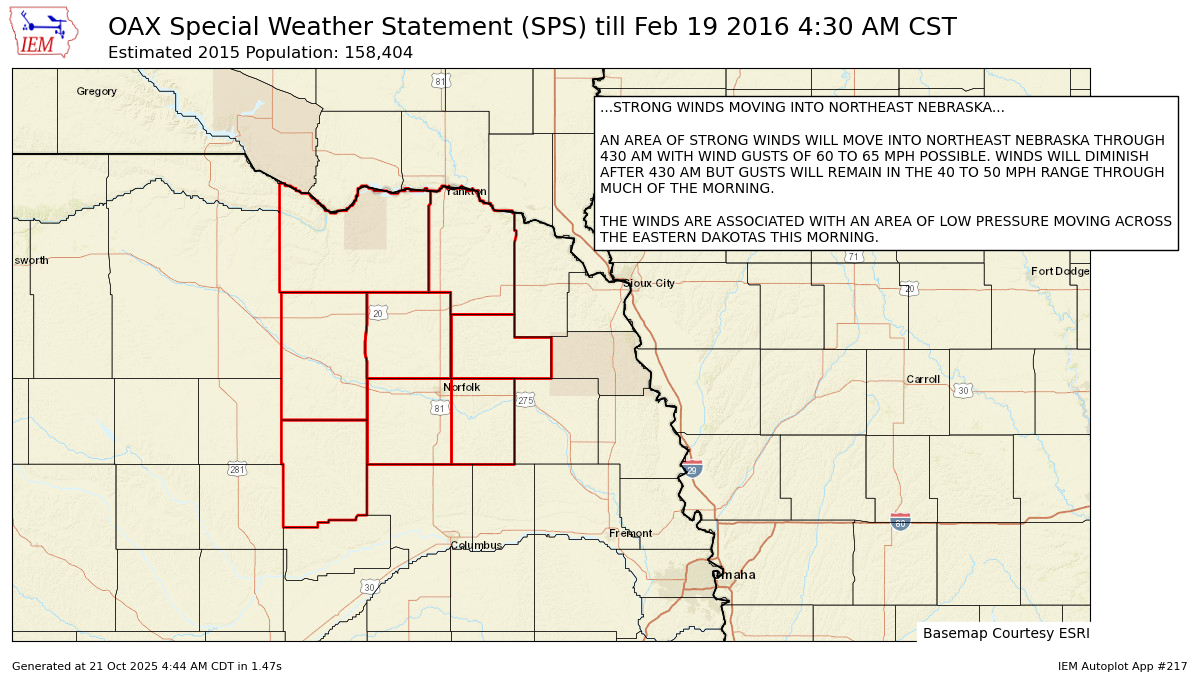
014
WWUS83 KOAX 190931
SPSOAX

SPECIAL WEATHER STATEMENT
NATIONAL WEATHER SERVICE OMAHA/VALLEY NEBRASKA
331 AM CST FRI FEB 19 2016

NEZ011-012-016>018-030>032-191030-
ANTELOPE-KNOX-CEDAR-PIERCE-STANTON-BOONE-MADISON-WAYNE-
331 AM CST FRI FEB 19 2016

...STRONG WINDS MOVING INTO NORTHEAST NEBRASKA...

AN AREA OF STRONG WINDS WILL MOVE INTO NORTHEAST NEBRASKA THROUGH
430 AM WITH WIND GUSTS OF 60 TO 65 MPH POSSIBLE. WINDS WILL DIMINISH
AFTER 430 AM BUT GUSTS WILL REMAIN IN THE 40 TO 50 MPH RANGE THROUGH
MUCH OF THE MORNING.

THE WINDS ARE ASSOCIATED WITH AN AREA OF LOW PRESSURE MOVING ACROSS
THE EASTERN DAKOTAS THIS MORNING.

$$

FOBERT
Autoplot 217 generated the following image below. You may find more customization options , like removal of RADAR, for this image by visiting that autoplot.
