SVR Count Ranks
Posted:
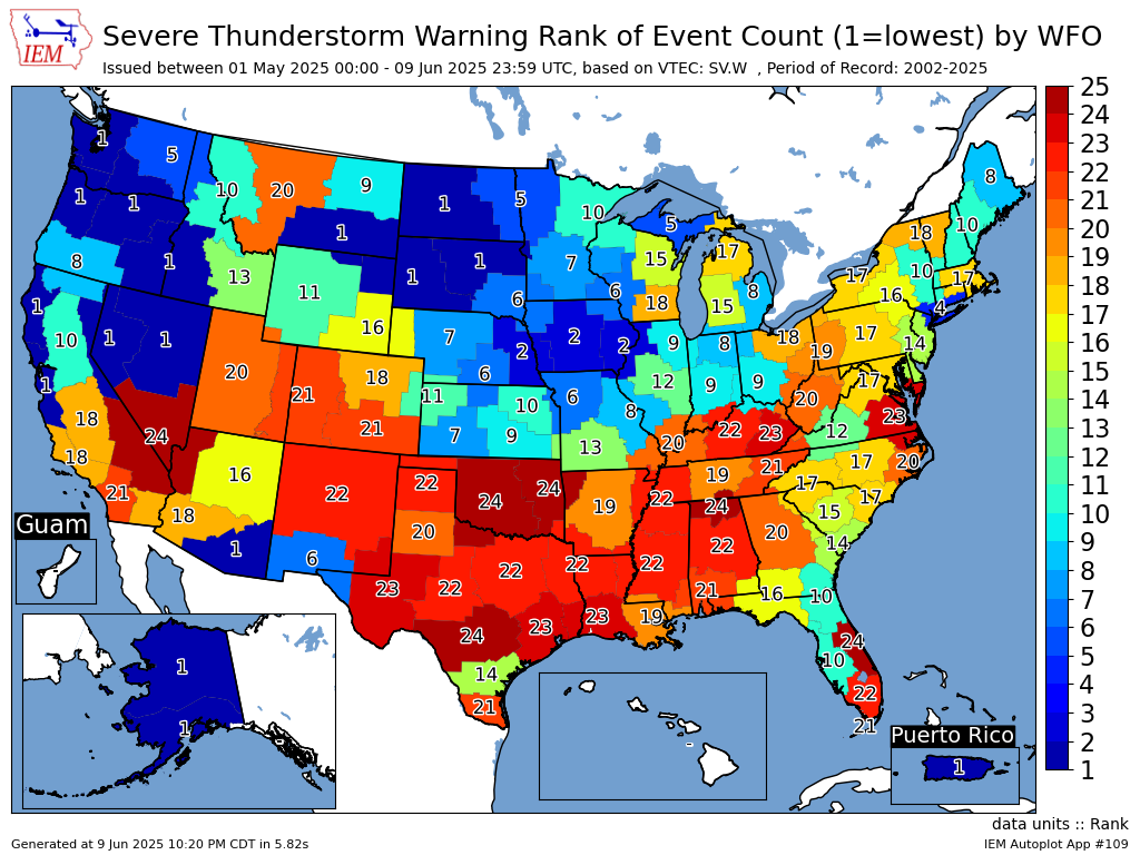
One of the Daily Features last week presented the Severe Thunderstorm Warning climatology and showed we are nearing the half way point of the severe weather season. The first half of the season has been quite quiet around Iowa as shown by the featured map presenting Severe Thunderstorm Warning count ranks for the 1 May through 9 June period by NWS Forecast Office. A period of record back to 2002 is chosen due to IEM archive completeness and so a value of 24 would indicate the largest total for this period of years. Conversely, a value of 1 would indicate the lowest total. Iowa joins our neighbors to the west and northwest with having a well below average number of warnings for this period.
Voting:
Good = 20
Bad = 0
Abstain = 1
Voting:
Good = 20
Bad = 0
Abstain = 1