Ring of Fire MCS
Posted:
The classic usage of the "Ring of Fire" term relates to the map presentation of the line of active volcano
and earthquake activity that rings much of the Pacific Ocean, or maybe the hit song by Johnny Cash.
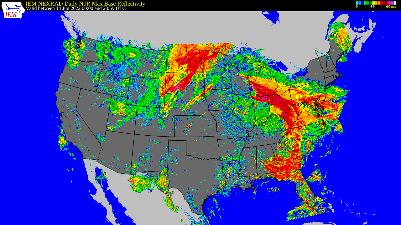
Meteorologists like to borrow this term to describe the path Mesoscale Convective Systems (MCS) will
take around strong high pressure systems during the summer time. The edge of the high pressure
systems is where temperatures are cool enough aloft to allow free convection and release of the high
energy air (warm + moist) being generated within the high pressure regime. Storms will seemingly
"ride" this boundary as moving away from the high features less unstable air and moving toward the
high features too warm of air aloft to allow storms. Such was the case yesterday with a storm complex
maturing Monday afternoon over Wisconsin and then travelling SE and eventually making an interesting
SW dive across Georgia on Tuesday. The featured map presents an IEM computed "maximum base
reflectivity" from a NWS NEXRAD mosaic. Effectively all of the 5 minute mosaics are overlain with the
strongest values of the period retained. The map is valid for a period between 7 PM Monday and 7 PM
Tuesday CDT. The map nicely shows the "ring" presentation with the path of the storms readily seen
around the high pressure system.
Voting:
Good = 18
Bad = 2
Voting:
Good = 18
Bad = 2