Too dry and too wet
Posted:
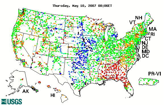
The featured image is a dot plot of stream flow precentiles from the USGS WaterWatch website. The blue and black dots represent very high flow levels and you can see them along the Missouri River in Western Iowa. The brown and red dots represent very low levels and you can see them in Northern Wisconsin and certainly in the Southeast US. These areas have also seen wild fires due to the very dry conditions recently.
Voting:
Good = 21
Bad = 4
Voting:
Good = 21
Bad = 4