Swath of ice
Posted:
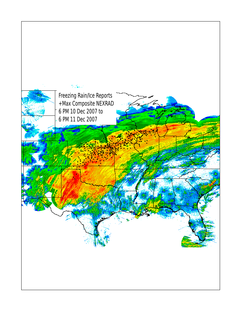
The storm system that brought freezing rain, sleet, and snow to Iowa has finally shifted off to the east this morning. A large area of the midwest from Oklahoma to Michigan saw significant ice accumulations. The featured map overlays freezing rain and ice reports on top of a max reflectivity composite from Monday. It is interesting to know how well these reports line up with the northside (the colder surface side) of the stronger NEXRAD reflectivities. Areas in green probably saw larger amounts of sleet or snow. You can find archives of these products on the iem, including the max reflectivity composite and GIS shapefiles of storm reports.
Voting:
Good = 14
Bad = 4
Tags: ice nexrad
Voting:
Good = 14
Bad = 4
Tags: ice nexrad