Past Features
This page lists out the IEM Daily Features for a month at a time. Features have been posted on most days since February 2002. List all feature titles.
Mon Apr 02, 2018

'17-'18 Winter Storm #24
02 Apr 2018 07:56 AM
April Fool's Day for Iowa was no trick but actual cold and even snow for far southern Iowa. The featured snowfall analysis shows 1-3 inches clipping the far southern border of the state. Heavier amounts were found just south into Missouri. The rest of the state suffered along with very cold temperatures struggling to breach even above freezing levels. Suffice it to say that our average daily high temperatures for early April are at much warmer levels. An another snow producing storm arrives tonight with northern Iowa receiving the heaviest totals.
Voting: Good - 5 Bad - 0
Tags: winter1718
Tue Apr 03, 2018

Only Few Colder Easters
03 Apr 2018 04:32 AM
Easter Sunday was very cold for Iowa. The high temperatures struggled to get above freezing. The actual date of Easter each year can vary from late March to late April and so the average temperature presented in the featured chart can be somewhat misleading. Even so, the high this year was way below the long term average and only a few previous years (2008, 1964, 1940, 1920, 1899, 1894) were colder. The forecast for the next seven days continues to show a struggle for warm or even average temperatures along with the snow that will fall today!
Voting: Good - 11 Bad - 1
Tags: easter 2018
Generate This Chart on Website
Wed Apr 04, 2018

'17-'18 Winter Storm #25
04 Apr 2018 08:04 AM
There has been no let up of winter even with our calendar now saying April. Heavy snowfall and bitter cold temperatures best describe Iowa's current weather. The featured analysis indicates the largest totals near the Minnesota border with no appreciable snowfall over southern Iowa. There is still more chances of snowfall in the forecast!
Voting: Good - 22 Bad - 3
Tags: winter1718
Mon Apr 09, 2018

'17-'18 Winter Storm #26
09 Apr 2018 07:53 AM
Could this finally be winter's last significant snow storm for Iowa? I suspect that most folks are hoping that the answer is yes. The featured map depicts the highest totals over north central Iowa with amounts over eight inches reported in select areas. The other big story with this event was the very cold temperatures with locations flirting near all time April lows around this event. Typically when we see snowfall in April, there is a warm side of the storm with rain reported, but not so with this event as it almost all fell as snowfall. The forecast has very warm temperatures in store later this week, but pessimism is strong after the last few weeks of not-spring weather.
Voting: Good - 9 Bad - 1
Tags: winter1718
Tue Apr 10, 2018

Very Cold Soil Temps
10 Apr 2018 05:34 AM
The featured chart displays yearly time series of daily average four inch depth soil temperature for Kanawha (north central Iowa). This year's values are shown in red with a simple day of year average based on period of record data shown in black. Soil temperatures for early April this year are way below average and at the bottom of the observed range. Values shown are at freezing and with all the cold with recent snowfall, there is likely frost still in the ground. Getting soil temperatures to warm and even dry enough levels to support the spring planting will be a challenge. The exciting news is that a few days of much warmer air temperatures are on the way, but a major storm system to end the week is expected to usher cold air back into the state for next week.
Voting: Good - 8 Bad - 0
Tags: soil4
Generate This Chart on Website
Wed Apr 11, 2018

Recently Mostly Blue
11 Apr 2018 05:34 AM
Whew, it finally felt a bit more like April in Iowa on Tuesday for most of the state. There were still a few areas that were laggards, but all of the state should feel like spring over the coming few days. The featured chart displays daily average temperature departures from long term averages for Des Moines. Up until yesterday, our weather this April has been dominated by cool conditions with the blue bars representing below average temperatures. Very warm days have been difficult to come by over the past 30 days, so our brief warm spell this week will feel great!
Voting: Good - 9 Bad - 0
Generate This Chart on Website
Thu Apr 12, 2018

April 11th Warmup
12 Apr 2018 05:34 AM
Our well advertised taste of spring weather is ongoing this week with a few more days to go before a big storm system arriving on Friday. The featured map displays an analysis difference between the warmest April 11th temperature vs the warmest temperature between 1 January and 10 April. Effectively, how much warmer was Wednesday than the entire year to date period. Positive areas on the map are highlighted. Central Nebraska was the biggest 'winner' yesterday with a large shown 10+ degrees warmer yesterday than all of the year to date period. This analysis is based on hourly Real-Time Meso-Analysis provided by NOAA.
Voting: Good - 13 Bad - 0
Fri Apr 13, 2018

Late for First Warning
13 Apr 2018 05:34 AM
A powerful spring storm system is expected to bring Iowa's first bout of severe thunderstorms this year on Friday. If it should prompt any Severe Thunderstorm or Tornado Warnings, they would be the first such warnings for the year. The featured chart presents the first date per year for such warnings based on unofficial IEM data. Only two years since 1986 come in later than this year, 1994 and 2003.
Voting: Good - 23 Bad - 0
Sun Apr 15, 2018

'17-'18 Winter Storm #27
15 Apr 2018 08:16 PM
Even though the calendar now says mid April, the winter season just will not quit. The brief warm up of last week now seems a distant memory with a major winter storm dumping tremendous amounts of snow over the Midwestern US. Far northwestern Iowa received 8 to 16 inches of snowfall and combined with cold and extremely strong winds, blizzard conditions prevailed for much of the weekend. Light snowfall does continue to fall this Sunday evening at the time of posting this map analysis, so it will likely need to be updated in the morning after more reports come in.
Voting: Good - 14 Bad - 0
Tags: winter1718
Tue Apr 17, 2018

Two Top Ten April Lows
17 Apr 2018 05:34 AM
To say that this April has been chilly thus far is a bit of an understatement. The featured chart displays the top ten coldest daily low temperatures for Mason City. Two days so far this month are shown within the top ten for April! The 1 thru 15 April period has been the coldest or nearly the coldest on record for almost all sites in the state. There is a light at the end of the tunnel, but first another snow storm is expected before much warmer temperatures arrive and hopefully stick around for a while!
Voting: Good - 9 Bad - 1
Tags: apr18
Generate This Chart on Website
Wed Apr 18, 2018

How to Warm the Soil
18 Apr 2018 05:34 AM
Today's chart is a bit of a deep dive into drivers for changes in soil temperature. A big current weather story is the cold soil temperatures statewide which are preventing crop planting progress. The featured chart attempts to look into what it takes to produce warmer soil temperatures, in particular four inch depth soil temperatures based on period of record data from the Ames ISU AgClimate weather station during the month of April. In focus is what may drive the day to day warming or cooling of soil temperatures. The top two panels present the relationship between the day to day change in air temperature and solar radiation with the response in day to day soil temperature. The bottom two panels look more into the absolute relationship between these three parameters. One may suggest that simply having sunny days are sufficient to increase soil temperatures. While the bottom left panel does show a positive relationship (increasing radiation increases the day to day temperature change), the correlation is a bit low and would indicate other factors are at play. The upper left plot shows a stronger relationship between day to day changes in air and soil temperatures, but this relationship is physically complex via the surface energy budget. Energy will flow from warmer soils to the air and from warmer air to the soil. During the spring time, a major source of warm air is from wind transporting warmer air into the state and from daytime mixing of warmer air aloft down to the surface. The moral of the story is that these plots seem to indicate that air temperatures are more important of a driver of soil temperatures than solar input. One could think of it this way, we just had our coldest 1-15 April period on record for air temperatures not wholly due to a lack of sunshine, but from dominant cold air masses being transported into the state. Of course, it also does not help to have snow covering the ground which will be added to today, sigh!
Voting: Good - 10 Bad - 1
Tags: soiltemp
Thu Apr 19, 2018

'17-'18 Winter Storm #28
19 Apr 2018 08:07 AM
Could this be the last snow producing storm of the season? Let us hope so! The featured map analysis shows extreme northern Iowa receiving upwards of twelve inches of concrete snowfall. This snow fell quickly on Wednesday and melted quickly off of roadways thanks to mid-April solar angle. It was remarkable to see most of northern Iowa return to seasonable driving conditions by late afternoon after getting that much snowfall in the morning.
Voting: Good - 8 Bad - 2
Tags: winter1718
Fri Apr 20, 2018
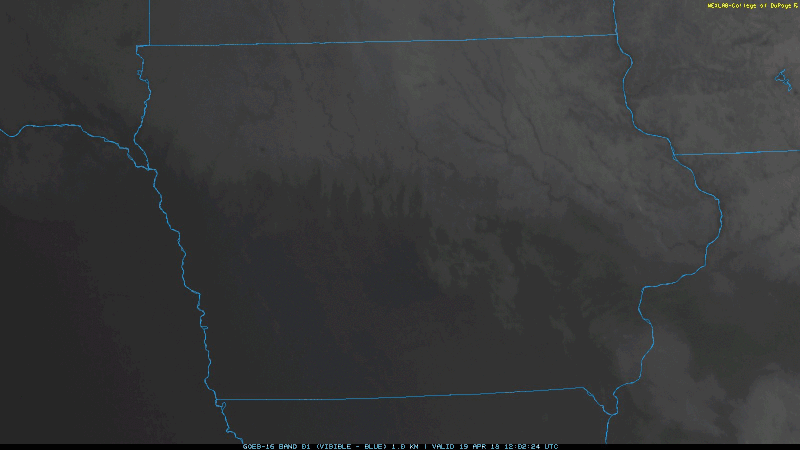
Natural Snow Removal
20 Apr 2018 05:30 AM
Mostly clear skies on Thursday allowed the sun to do some much needed snow removal work over northern Iowa. The clear skies also allowed various satellites to monitor the progress! The featured lapse is from the GOES-East satellite from about 8 AM till 7 PM on 19 April 2018. You can easily see the snow line creep north as the snow is melted away. The snow that remained overnight is helping to create record or near record low temperatures over Iowa on Friday.
Voting: Good - 24 Bad - 2
Tags: satellite
Mon Apr 23, 2018

Late for First 70+
23 Apr 2018 05:35 AM
It was like a miracle occurred and temperatures were above average on a Sunday for much of the state, well sans the areas still with some pesky snow cover left. Des Moines hit 70+ for the first time this year. With the date being 22 April, this was one of the latest dates on record for the site as shown by the featured chart. The chart compares the first date of hitting 70+ for the high temperature and the number of days that year at or above that level. Having such a late date does not doom the season total as this level is hard to be under with most of the summer season.
Voting: Good - 10 Bad - 0
Tags: 2018
Generate This Chart on Website
Tue Apr 24, 2018

Estherville Struggle
24 Apr 2018 05:34 AM
The struggle has been real for much of northern Iowa this spring with the numerous rounds of snow and cold temperatures. The featured calendar shows daily high temperature departures from long term average for Estherville. Positive values are depicted in red and there is very little red to be found on this calendar since the first of March including all of April. This chart also depicts seven Sundays in a row with below average high temperature, which has been noticed in other parts of the state as well. It is an open question when this site will get above average, it may take until early next week as some cooler temperatures are in the forecast again.
Voting: Good - 21 Bad - 1
Generate This Chart on Website
Wed Apr 25, 2018

April 4 PM Temps
25 Apr 2018 05:34 AM
Temperatures warmed again nicely on Tuesday making for a three day stretch of excellent weather for most of Iowa. The Des Moines Airport reported 75 degrees at 4 PM. The featured chart presents April average 4 PM temperatures for the site by year along with the long term average and simple linear regression. The plot indicates a warming trend over the years and certainly most of the recent years have been above long term average. This year is a noted exception, but there is still a few days left to pull that average up and the forecast would indicate warmer temperatures through the end of the month.
Voting: Good - 6 Bad - 2
Tags: apr
Generate This Chart on Website
Thu Apr 26, 2018

Wind Component Climatology
26 Apr 2018 05:34 AM
Typical weather station wind measurements are horizontal wind speed and direction. This two dimensional value can broken apart into one dimensional components. The typical convention is to express wind speeds in components oriented north/south and east/west. The "u" component is the east/west one dimensional speed and the "v" component is the north/south one dimensional speed. The featured chart presents the climatology of these two values (top panel) based on long term data from the Des Moines Airport weather station. The bottom panel is the simple average of the magnitude of the wind speed. This type of plot tells an interesting story about the "v" component wind. This wind is typically responsible for the warm and cold air mass transport into Iowa. The plot shows a clear annual cycle between northerly winds (negative v) during the cold season and southerly winds (positive v) during the warm half. The transition from northerly to southerly happens about this time of year! Of course, not every day during the warm season experiences southerly winds, but when you average all the data out it is southerly.
Voting: Good - 9 Bad - 0
Tags: wind
Generate This Chart on Website
Fri Apr 27, 2018

Quickly Warming
27 Apr 2018 05:32 AM
The weather has been nearly perfect this week for most of Iowa with warmer air temperatures and sunshine helping to warm and dry soils allowing for spring planting to commence. The featured chart displays the daily range of four inch depth soil temperatures near Kanawha (north-central Iowa). The chart nicely depicts the story of this April. The days with no change in temperature at about 32F are those with snow cover! Once the snow cover goes away, the soil temperatures start to show life. The data for this site would indicate it only took about three days after the snow cover left for soil temperatures to exceed the magical 50 degree threshold.
Voting: Good - 9 Bad - 2
Tags: soiltemp
Generate This Chart on Website
Mon Apr 30, 2018

Increasing Water Stress
30 Apr 2018 05:31 AM
The current drought situation in Iowa is complex to analyze. Up until last week, April was extremely cold for all of Iowa and very snowy for parts of Iowa. This snow was loaded with water, which provided some much needed moisture, but the final destination of melting snow over frozen ground can be tricky. The cold weather put a late start to the planting season and also limited the atmospheric demand of water from the soil. The featured chart displays the aridity index for Centerville. The area got some needed rain last October and earlier this spring, but April has been very dry. The aridity index combines temperature and rainfall departures. The 14 day trailing index is currently about at zero even without any rain over the past 14 days. The very cold temperatures two weeks ago are masking the dry weather. With warmer weather, we effects of the dry conditions are much more noticeable. For example, the past few days have seen Red Flag (Fire Weather) Warnings.
Voting: Good - 10 Bad - 0
Tags: aridity
Generate This Chart on Website