Saturday Wake Low
Posted:
On Friday evening, a powerful cluster of thunderstorms developed into a Mesoscale
Convective System and moved east and south bringing some much needed rainfall to
southern Iowa early Saturday morning. These systems can have an expansive area of
precipitation associated with them and sometimes this area can decay quickly leading to
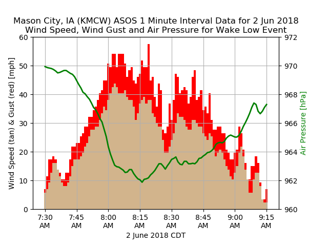
what happened on Saturday morning, a "Wake Low". This even was captured nicely by the
Mason City Airport weather station and the featured chart presents one minute interval data
from the event. These events are marked by rapid drops in pressure, which drive a rapid
increase in wind speed. Sure enough, the chart shows the increase in wind while the
pressure continued to drop and then moderation of the wind as the pressure returned to
background state condition. Strong events like these, with winds gusts over 50 MPH, tend
to do damage as was the case with wind damage reported over north-central Iowa.
Voting:
Good = 8
Bad = 0
Tags: wakelow
Voting:
Good = 8
Bad = 0
Tags: wakelow