Ames Precipitation Gradient
Posted:
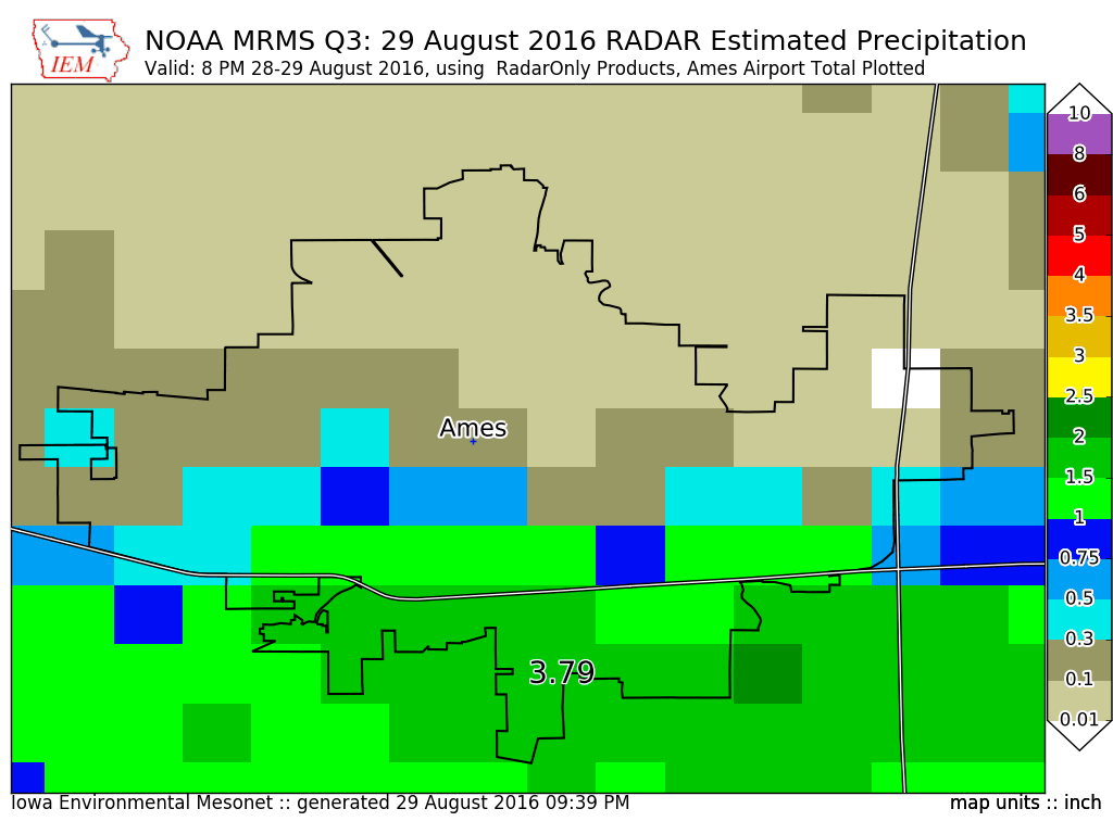
A few years back, the IEM presented a local seminar on the difficulties of answering a
simple question like: "How much did it rain in Ames on a given day?" The rainfall on
Monday afternoon was an excellent case in point. The featured chart displays high
resolution precipitation estimates by NOAA's MRMS project over the Ames area. The map
outline presented is roughly Ames's urban area. The Ames Airport reported just over 3.5
inches of rain in about an hour's worth of time. Meanwhile, portions of northern Ames got a
few hundredths! There is even one pixel analyzed to have gotten less than 0.01", which is
the common lower limit of measure. The RADAR based estimates presented are even a bit
underestimating what fell in the most intense locations.
Voting:
Good = 15
Bad = 0
Tags: ames
Voting:
Good = 15
Bad = 0
Tags: ames